04/26/2010 to 04/27/2010
Another trip to Death Valley. Our goal this time was to try and see the west side of the Park which we've missed on our other visits. For the most part our plan worked out well, however Ubehebe Crater was closed due to road construction as was Dantes View, and the Keane Mine and Mill are permanently closed and might qualify as a Superfund site since it's so contaminated from mining. Oh, well. We did manage to get in quite a bit and feel we have pretty well covered Death Valley for the present.
- Wildrose Peak Hike
- Charcoal Kilns
- Eureka Mine
- Aguereberry Point
- Salt Creek Trail & Pupfish
- Darwin Falls
- Father Crowley Point
- Mosaic Canyon
- Leftovers
Since our timing was a week off for cool weather we were a bit concerned about the heat on our hike. WRONG. This trail starts at about 6,800 feet and it was not hot. In fact, we started to get concerned we'd be cold on the trail. However, with an elevation gain of 2,200 in a little over 4 miles, we managed to stay warm even in the brisk breezes.
Once you reach the top there is a bronze US Geological Survey marker and a notebook to attest you visited the top. The views were just amazing and we'd love to do it again.

The start of Wild Rose Trail

It did not take long to see some great views along the trail

Just taking in some scenery

This is the last section before you reach the "top" marker

We joined some other hikers who had gotten to the top. They man on the ground is looking for his name from a previous trek

The erect slab is a marker of sorts, and the metal box has slips of paper and notebooks from hikers who have come before

The US Geological Survey marker for Wild Rose Peak - set in 1949

We were discussing other trips and trails with Telescope Peak over our shoulders

Telescope Peak is the highest point in Death Valley at 11,331 feet. They recommend ice cramps and picks if you hike it in the snow. You can actually see the trail traversing the side of the mountain

Looking off toward Badwater
These were built in 1876 to provide charcoal for smelting the silver and lead ore. We've seen the remains of other charcoal kilns but these are the best preserved. They sit at the base of the Wildrose Trail so you can't miss them if you take the hike, although one couple did actually manage and were rather chagrined when I asked "you mean those behind you?" Yup, check into tourist mode; leave your brain in idle. We all do it.

The history of the kilns


You see the kilns as you come back down Wild Rose Trail. Yes, you have to pass them to start up the trail as well


You can really see the various rocks used in the construction. They are quite lovely to look at

My Vanna imitation inside one of the kilns

Once again I'm in the shot to give a sense of the size of a kiln


After our little 8 mile hike and lots of shots of the kilns, we wanted to climb around an old mine, so the only one we had not done yet was the Eureka Mine.
This sits on the road leading up to Aguereberry Point. Some of the head frame is still standing but most of the structures are gone. The mine itself is a roost for the Townsend big-eared bat and the entrance is closed by a bat friendly gate. Yea for the bats

A little info on the Eureka Mine and Mr. Aguereberry. With all the cyanide and mercury used in gold processing it's amazing all the sites in Death Valley aren't on the Superfund list

I think this is part of the old headframe. It's the first thing you see when you park


This is the Cashier Mill. I know this 'cause there's a sign that says so

See, I told you

There are still some tracks left that go into one of the shafts

Inside one of the mines

Crawling around inside another one of the shafts

I have no idea what this old building was used for

Another shaft entrance

There's not much clearance in these shafts

Lots and lots of debris is stashed inside these old shafts

Since many shafts are in disrepair there are lots of shafts of light streaming. Very artsy


The obligatory old car

Standing on what's left of a wall from some large building

Looking down on Harrisburg Townsite. The road to it is now closed, although I have no idea why other than the buildings are falling apart
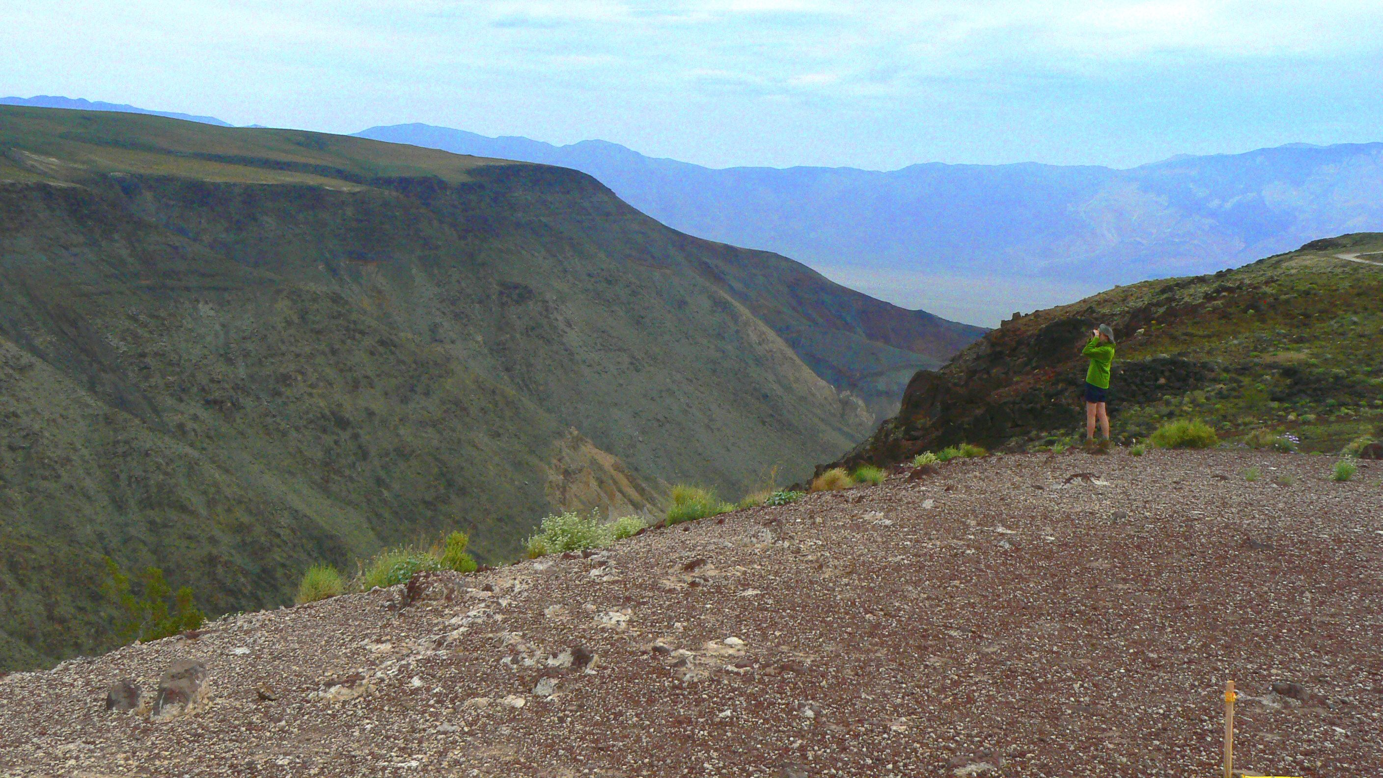
A nice little drive up the dirt road from the Eureka Mine brings you to Aguereberry Point. I am still not sure why they gave it Mr. Aguereberry's name, but they did. The drive is fun and the views are nice, but I'm not sure there is a reason to go there other than to say you've been to it. Why am I flashing to that old movie "If it's Tuesday it Must be Belgium"?
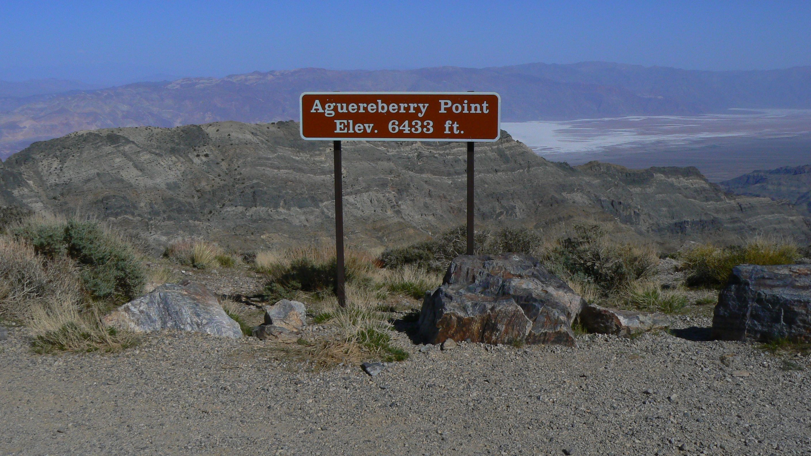

Looking out from the Point

A shot of part of the road that takes you up to the Point


This is actually a salty creek that flows year round, but pupfish are most visible in spring when they are mating. Pupfish are the last known survivors of what is thought to have been a large ecosystem of fish species that lived in Lake Manly before it dried up at the end of the last ice age. These guys are really, really small - about 2 inches long - so getting shots of them as they're swimming around is not easy.

Info about Salt Creek and its inhabitants

Pupfish Info. Biologist Carl L. Hubbs said they acted like puppies when they chased each other around, thus the name Pupfish

The boardwalk takes you through the marshes and along Salt Creek

It was very, very windy when we were there

OK, I know it's hard to see, but those little dark specks are pupfish

The wind blowing over the water did not make it easy to take group pictures


You can see the creek feeds a lot of vegetation

Males are very bright

Females are not as flashy

Here are a male and female - you really need to look closely

Another female

Another male

These guys are not only small, they are really quick when they move
Darwin Falls is a waterfall located on the western edge of Death Valley National Park near the Panamint Springs area. The Falls are fed by Darwin Creek one of the four perennial streams in the Park. Darwin Falls and Creek are fed by the Darwin Wash, which is in turn fed by the Darwin Bench. OK, enough Darwins.
The walk into the falls begins through a very dry rocky wash which gives way to a path along the Creek that is lined with rushes and willows. You have to cross the water several times, and you might get your feet wet depending on your balance but the falls in the grotto is well worth the trip.


We were the first to arrive that morning

The approach to the Creek trail is typical Death Valley scenery

Once you get along the Creek it all changes

Just one of the impromptu crossings across the Creek

Darwin Falls

Great reflection in the pool at the base of the Falls


Going back to the truck
Father Crowley was a priest who ministered to the residents in the 1930's and this was supposedly one of his favorite spots. In appreciation for his work the point was named after him. You do get some great views from up here so it is worth the drive.

Looking back along the road up to the Point

The wind was really blowing - the flats were roiling with dust

The area had quite a few flowers

This is Rainbow Canyon. I'm sure on a clear, sunny day it's quite colorful

Another shot of the Canyon, this time with more color

One slope was covered with these tiny purple flowers

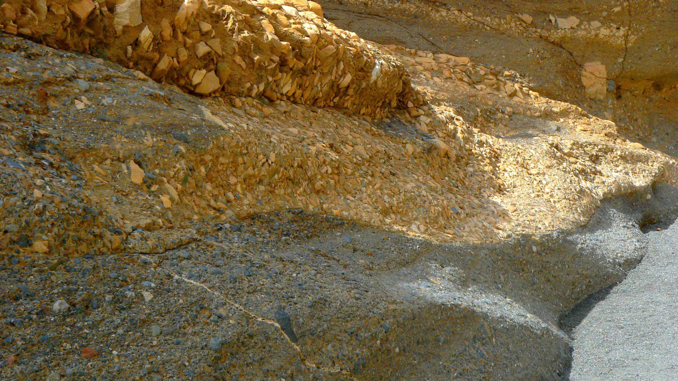
Since Ubehebe Crater was a parking site for construction vehicles and the Keane Wonder Mill ann Mine are closed to the public because they are unsafe - falling apart and toxic respectively - we decided to take another walk up Mosaic Canyon. This is just a great place to look at rocks. Conglomerates of stones flow into smoothed sandstone in a very unique way. I'll spare you a geological description (you can view the link if you're curious) and just say it's a must see stop in the park.

These rocks have been scaled so often they're a little slick

I call these "mixed media" since it really is 2 types of rock next to each other

Another section of conglomerate looking rock next to soft sandstone sitting on another layer that is almost white

Smoothed from years of water rushing down the canyon

Two other people winding their way through the rocks


Different colors but still pretty


More "mixed media" with more colors

I like this because it shows about 4 different colors and formation types

Once through the slots this is what is at the last portion of the canyon. Soft and hard to walk in


